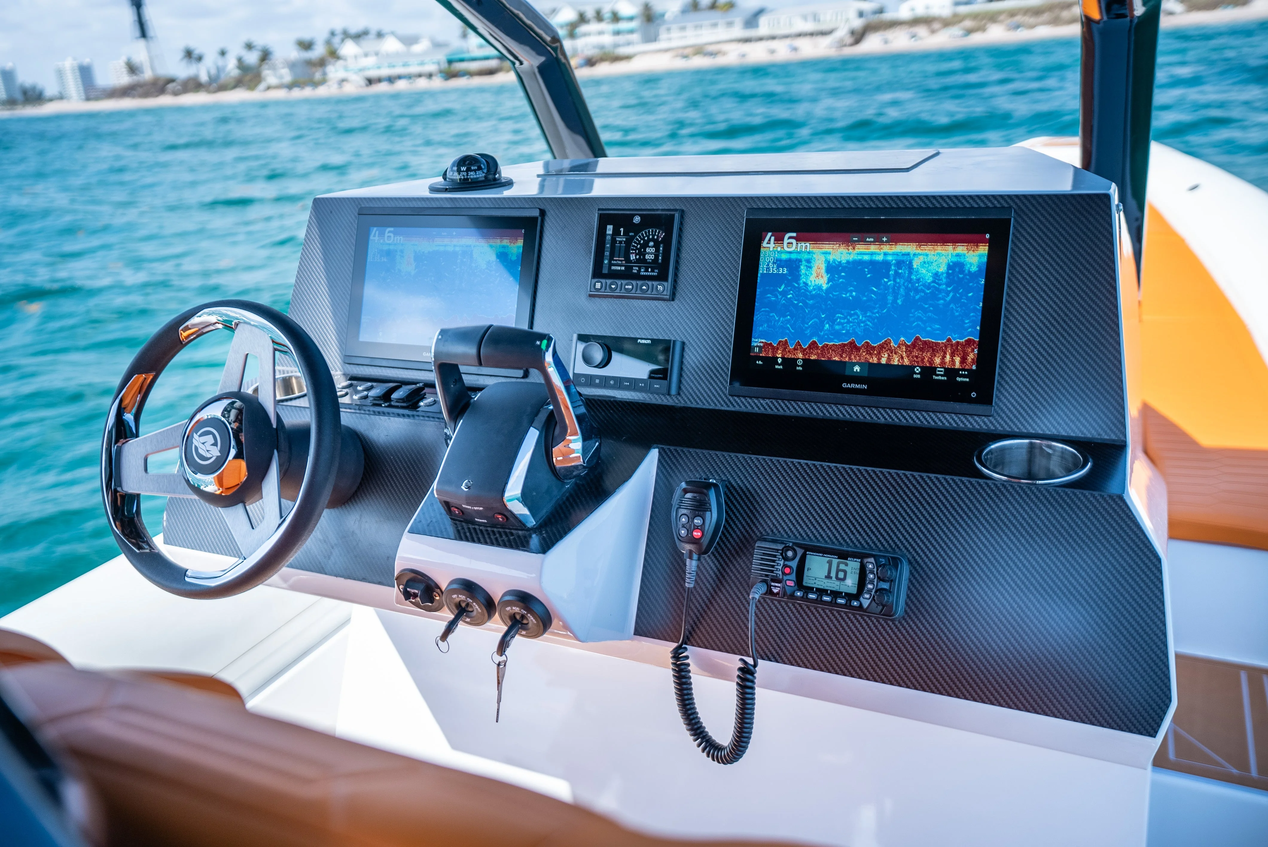
How to Choose a Marine GPS for Fishing
The best marine GPS for fishing is not necessarily the unit with the largest screen or the most features. It should match your boat, fishing style, local waters, and willingness to install and maintain additional equipment. A GPS can show your position and help you return to productive locations, while a chartplotter adds electronic navigation charts and a fish finder uses sonar to reveal depth, structure, and suspended targets. Before comparing models, decide whether you need one of these functions or a combination of all three.
Marine GPS Features That Help Locate Fish
GPS does not detect fish directly. Its value comes from helping you mark, revisit, and organize the places where fish are likely to hold. Look for simple waypoint creation, a clear track-history display, and enough internal storage for routes and saved locations. A waypoint might mark a wreck, reef edge, bait concentration, drop-off, or the exact position of a successful drift. The ability to name waypoints and sort them by area or fishing pattern becomes increasingly useful as your collection grows.
For offshore fishing, route planning and reliable navigation are especially important. A unit should show course over ground, speed, heading, distance to waypoint, and estimated arrival information in a format that can be read quickly while operating the boat. Tide and current information can improve planning when supported by compatible charts or services, but availability varies by region. Treat these features as planning aids rather than substitutes for local knowledge, a paper chart, or safe seamanship.
A fish finder adds another layer of information. Down-looking sonar can help identify depth changes and bottom composition, while higher-frequency technologies may provide more detail in shallower water. Side-looking sonar can reveal structure away from the boat, but it requires suitable water conditions, careful interpretation, and a compatible transducer. Fish arches and colored marks are not definitive identifications; learn to compare sonar returns with depth, speed, bottom shape, and the behavior of bait.
Chartplotter, Fish Finder, or Combo Unit
A dedicated marine GPS is a sensible choice if your priority is navigation, waypoint management, and dependable position information. It may cost less and be simpler to operate than a multifunction display, particularly on a small boat that already has separate depth equipment. The trade-off is that you will not see chart and sonar information together, and future expansion may be more limited.
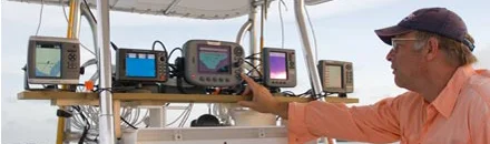
A chartplotter is designed around electronic charts and navigation, often with a brighter display, route tools, and integration with other marine electronics. It is useful for anglers who fish unfamiliar coastlines or large inland waters and want a clear view of channels, hazards, contours, and marked locations. Check whether the unit includes charts for your region or requires a separately purchased chart card. Coverage and detail can differ significantly between coastal, inland, and international areas.
A combo unit combines GPS, chartplotting, and sonar in one display. This can save console space and make it easier to compare your boat position with bottom detail. Its disadvantages are a higher purchase price, a more involved installation, and a greater dependence on transducer compatibility. If one display fails, you may lose several functions at once. For many fishing boats, however, a combination system offers the most useful balance of navigation and fish-finding information.
Screen Size, Visibility, and Controls
Choose screen size according to viewing distance, console space, and the number of panes you expect to use. A compact display may be adequate when mounted close to the helm and used mainly for navigation. Larger screens make split views more practical, allowing a chart, sonar image, and instrument data to remain visible together. Measure the available mounting area before buying, including room for cables, connectors, ventilation, and access to mounting hardware.
How to Choose the Right Fishfinder or MultiFunction Unit for Your Boat at West Marine
Sunlight readability matters more on the water than showroom appearance. Look for a high-brightness display with adjustable backlighting and a viewing angle suited to your helm. Glare, polarized sunglasses, spray, and a wet screen can all reduce legibility. Physical buttons or a rotary control can be easier to use with wet hands than a touchscreen, while touchscreens offer fast panning and menu access. Hybrid controls are often a practical compromise. Confirm that the interface remains usable at night without excessive brightness.
Consider how the unit will be protected and positioned. Marine GPS Accessories such as protective covers, sun hoods, spare power leads, and mounting hardware can improve everyday reliability. RAM Mounts systems may be useful when you need adjustable positioning or want to remove the display between trips, but verify the weight rating and the mounting surface. Use only hardware appropriate for vibration, spray, and the structure of your particular boat.
GPS Accuracy and Chart Detail
Most modern marine GPS receivers provide sufficient accuracy for ordinary navigation, but apparent precision depends on satellite reception, antenna placement, signal conditions, and the quality of the displayed chart. An external antenna can help when the display is installed under a hardtop or in a location with limited sky view. Avoid mounting the antenna close to equipment that could cause interference, and follow the manufacturer’s installation guidance.
Chart detail is just as important as receiver accuracy. Compare shoreline outlines, depth contours, navigation aids, restricted areas, wrecks, marinas, and channel information for the waters you actually fish. A chart with frequent updates may be more valuable than one with a longer list of advanced functions. Waterproof Charts can also be a useful backup reference, especially if electronics lose power or become unreadable. Electronic charts should support, not replace, a sensible navigation plan and awareness of changing conditions.
Check the cost and update method before committing to a chart system. Some charts are supplied on cards, while others are downloaded or updated through a connected account. Confirm whether updates are included for a limited period or require a subscription. Also check regional licensing, because a unit that appears suitable in a general listing may not include detailed coverage for your home waters.
Recommended products
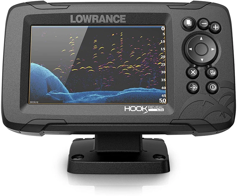
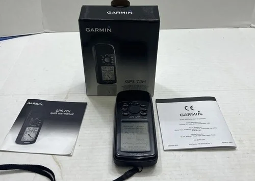
Use these catalog picks as a shortlist for how to choose a marine gps for fishing. Compare measurements, materials, and return terms side by side instead of buying from a photo alone.

Networking and Transducer Compatibility
If you may add radar, a second display, autopilot, engine data, AIS, or a VHF radio later, investigate the unit’s networking standards and available ports now. Compatibility is not guaranteed simply because two devices come from the same manufacturer. Check supported networks, connector types, software requirements, and whether the display can share waypoints, routes, and sonar information across the system.
Transducer selection deserves equal attention. Confirm the display supports the transducer’s frequency, power, connector, mounting style, and sonar functions. A transducer mounted through the hull, on the transom, or through a trolling motor can produce different results and installation requirements. Hull material, deadrise, trailering habits, and boat speed all affect the appropriate choice. If you are replacing an existing display, do not assume the old transducer will plug directly into the new one.
Power and communications equipment should fit the same operating environment. If the boat has an Icom radio or another onboard communication system, check whether the GPS can share position data for location reporting and emergency functions. Audio integration can be convenient on some multifunction displays, but it should not take priority over clear navigation data and dependable communications. A Car navigation unit may be useful on the road, but it is not a substitute for marine charts, waterproof construction, or water-specific navigation features.
How to Compare the Available Catalog Picks
When comparing the two catalog picks, use a consistent pros-and-cons approach rather than choosing by screen size alone. Note each model’s strongest advantage, such as lower installation complexity, better split-screen visibility, broader chart coverage, or included sonar functions. Then record the main compromise, such as a smaller display, added chart costs, fewer networking ports, or the need to purchase a compatible transducer. Compare the complete installed cost, including charts, mounts, wiring, transducer, and protective accessories, because the less expensive head unit is not always the less expensive system.
A Practical Buying Checklist
Before ordering, write down your boat’s available mounting dimensions, power supply, existing transducer model, preferred chart region, and likely future additions. Decide whether you operate mostly in daylight, whether you need split-screen sonar, and whether physical controls are important in rough conditions. Confirm waterproofing, warranty terms, software support, chart-update pricing, and the availability of replacement cables. Finally, choose a location where the screen can be seen from the helm without obstructing essential instruments or reducing access to the controls. The right marine GPS should make navigation and fishing decisions clearer, not turn the console into a distracting collection of features.
FAQ: How to Choose a Marine GPS for Fishing
What features should I look for in a marine GPS for fishing?+
Prioritize accurate GPS positioning, detailed nautical charts, waypoint marking, route planning, and a screen that remains readable in bright sunlight. If you want depth and fish-finding data, choose a combo unit with sonar and confirm that the GPS supports the transducer you plan to use.
Should I buy a chartplotter, fish finder, or combo marine GPS?+
Choose a chartplotter if navigation and chart detail are your main priorities, or a fish finder if locating structure and viewing depth returns matters most. A combo marine GPS combines both functions and is often the most practical choice when space, budget, or installation options are limited.
What screen size is best for a fishing marine GPS?+
Choose the largest screen that fits your console without blocking other controls or reducing visibility. Larger displays make charts, sonar views, and split-screen layouts easier to read, while physical buttons or a responsive touchscreen can make operation simpler in spray, glare, or rough conditions.
How accurate should a marine GPS be for fishing?+
Look for a unit with reliable position tracking and clear waypoint display so you can return to reefs, wrecks, channels, and productive spots. Accuracy also depends on chart quality, satellite reception, mounting position, and how precisely you save and label locations.
How do I check marine GPS compatibility with charts, networking, and transducers?+
Before buying, confirm that the unit supports the chart format and coverage area you need, along with the transducer type and sonar features you intend to use. If you plan to add radar, an autopilot, a second display, or engine data, check the available networking connections and compatibility standards.