How to Choose a Marine GPS for Boating to Events in Providence
Boating to an event can turn a routine outing into a memorable day on the water, but Providence-area rivers and coastal approaches demand more than a basic road-navigation app. A dependable marine GPS should help you understand channels, bridges, shoals, currents, weather, and your return route after dark. Start by matching the unit to your boat, your experience level, and the kind of trips you expect to make. A small console boat heading up the Providence River has different needs from a larger cruiser making repeated coastal runs. Before buying tickets or setting a departure time, study the venue location, nearby marinas, dock policies, and the likely traffic around the event.
Marine GPS Features for Reaching Events in Providence by Water
The most useful marine GPS feature is a clear chartplotter display that shows your position in relation to marked channels and hazards. Look for readable depth shading, buoy symbols, bridge information, marina points of interest, and a route-planning tool that lets you set waypoints before leaving the dock. A unit with a bright screen is especially valuable when glare reflects off the water. Some displays use a White daytime palette and automatically switch to lower-light colors at night, which can make a major difference when returning from an evening event.
Screen size matters, but bigger is not always better. A 7-inch display is often a practical compromise for a center console, while a 10-inch model is easier to read from the helm of a larger boat. Check the viewing angle, touch-screen responsiveness, and whether physical buttons remain available when the screen is wet. Garmin offers accessible chartplotters with broad accessory support, while Simrad is worth considering if you want a more integrated helm system with radar, sonar, or autopilot controls. Compare the interface in person if possible; a feature-rich unit is only useful if you can operate it quickly under pressure.
Connectivity can add convenience, but it should not replace basic navigation skills. Wi-Fi may allow you to update charts or mirror information to a phone, and networking can combine GPS data with depth, engine, or radar readings. A reliable internal antenna is important on boats with enclosed helms, while an external antenna may improve reception on larger vessels. If your boat has electrical limitations, review power draw and installation requirements. Xantrex equipment is commonly associated with marine power management, so confirm that your boat's charging and battery setup can support the display, networking equipment, and other electronics during a full day away from the dock.
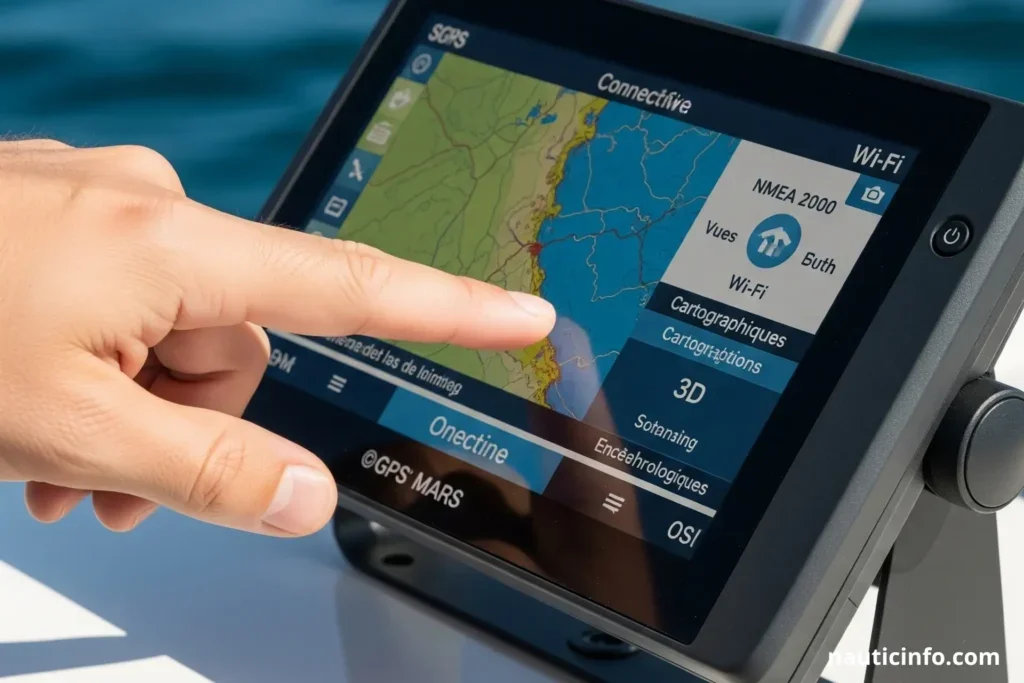
Chart Coverage, Tides, and Weather Planning
Chart coverage should be your first comparison point after screen quality. Confirm that the included charts cover Narragansett Bay, the Providence River, approaches to local marinas, and any coastal water you may cross. Look for frequent update options and a clear explanation of whether updates are free, subscription-based, or purchased separately. A chartplotter can show a safe route only when its underlying data is current. Paper charts or a second navigation source remain sensible backups because electronics can lose power, suffer a software problem, or become unreadable in heavy spray.
Tide and current information is particularly important around Providence. Depths shown on a chart are not a guarantee of the water beneath your hull at a particular moment, and current can affect both arrival time and fuel use. Choose a GPS that displays tide stations and lets you review high and low water predictions. For a shallow-draft boat, plan conservatively around bridge approaches, narrow channels, and unfamiliar docks. Save both the destination and a nearby alternate marina as waypoints so a changing tide, crowded waterfront, or closed dock does not force an improvised decision.
Weather planning should happen before you cast off, not only after the sky changes. Review wind direction, visibility, thunderstorms, and the forecast for the return window. A GPS with weather overlays can be useful, but verify serious conditions through an official marine forecast and keep a portable weather receiver or phone available in a protected location. Events often create a fixed schedule, yet a ticket does not make poor conditions safer. Leave enough time to arrive without rushing, and be willing to watch the event from shore if wind, fog, or thunderstorms make the trip unsuitable.
Portable vs. Fixed-Mount Marine GPS Systems
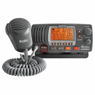
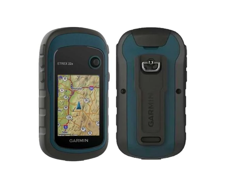
A portable marine GPS is a sensible choice for renters, smaller boats, or owners who use more than one vessel. It can be moved between boats, stored securely when you are away, and powered from a battery or 12-volt connection. The trade-offs are a smaller screen, less weatherproof installation, and possible difficulty keeping the device charged on a long outing. Use a robust mount with a safety tether, and test the unit in its intended position before the event day so glare, spray, or a blocked antenna does not surprise you.
I Tested the BEST Marine GPS for 30 Days and Here's What Happened
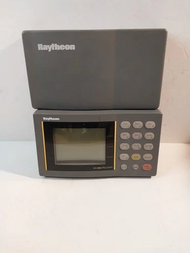
A fixed-mount chartplotter provides a cleaner helm installation and usually offers a larger display, stronger networking options, and better integration with a transducer or radar. It is the better long-term choice for a boat used regularly in Providence-area waters. Installation should include an appropriate fuse, protected wiring, a stable mounting surface, and enough clearance to operate controls while maintaining a lookout. Ask an installer about waterproof connectors and backup power rather than treating the GPS as an isolated screen.
Whichever format you choose, practice the basic functions at the dock. Learn how to zoom between an overview and a close chart view, create and delete waypoints, follow a route, mark your actual position, and switch to a track that shows where you have been. Test alarms for shallow water, off-course travel, and arrival at a waypoint. A short practice run is more valuable than discovering on event night that the route line is difficult to interpret.
Safety Tips for Navigating Busy Providence-Area Waters
Busy event periods can bring extra recreational boats, water taxis, commercial traffic, and distracted operators into the same waterways. Keep a proper lookout instead of steering by the GPS alone, follow navigation rules, and slow down near docks, anchored boats, and congested channels. Know the limits of your vessel and crew, including fuel range and passenger capacity. Everyone should have a properly fitted life jacket, and the operator should brief passengers on where to sit and how to respond if the boat loses power.
Plan the return trip before arrival. Mark the marina entrance, identify well-lit reference points, and confirm that your chartplotter can be dimmed without losing essential information. Carry a charged phone in a waterproof case, a handheld light, a sound-producing device, and enough fuel for a detour. If you are attending events in Providence, allow extra time for docking and passenger transfers rather than trying to match the final performance or game moment exactly. Checking schedules and venue details in advance can help you choose a departure window that avoids the busiest traffic.
Finally, consider the full travel plan if your group may continue overland after docking. A regional venue such as Gillette Stadium may be part of a broader New England itinerary, but it is not a substitute for checking the actual route, parking, and marina-to-venue transfer. Treat each destination as a separate navigation plan, and do not assume that a GPS route designed for one harbor will account for road travel or event-day restrictions around Gillette Stadium. With current charts, tide awareness, tested equipment, and a conservative schedule, your marine GPS becomes a planning aid rather than a source of false confidence.